Caloosahatchee D'Town Alternative Multimodal Feasibility Study
About the Study
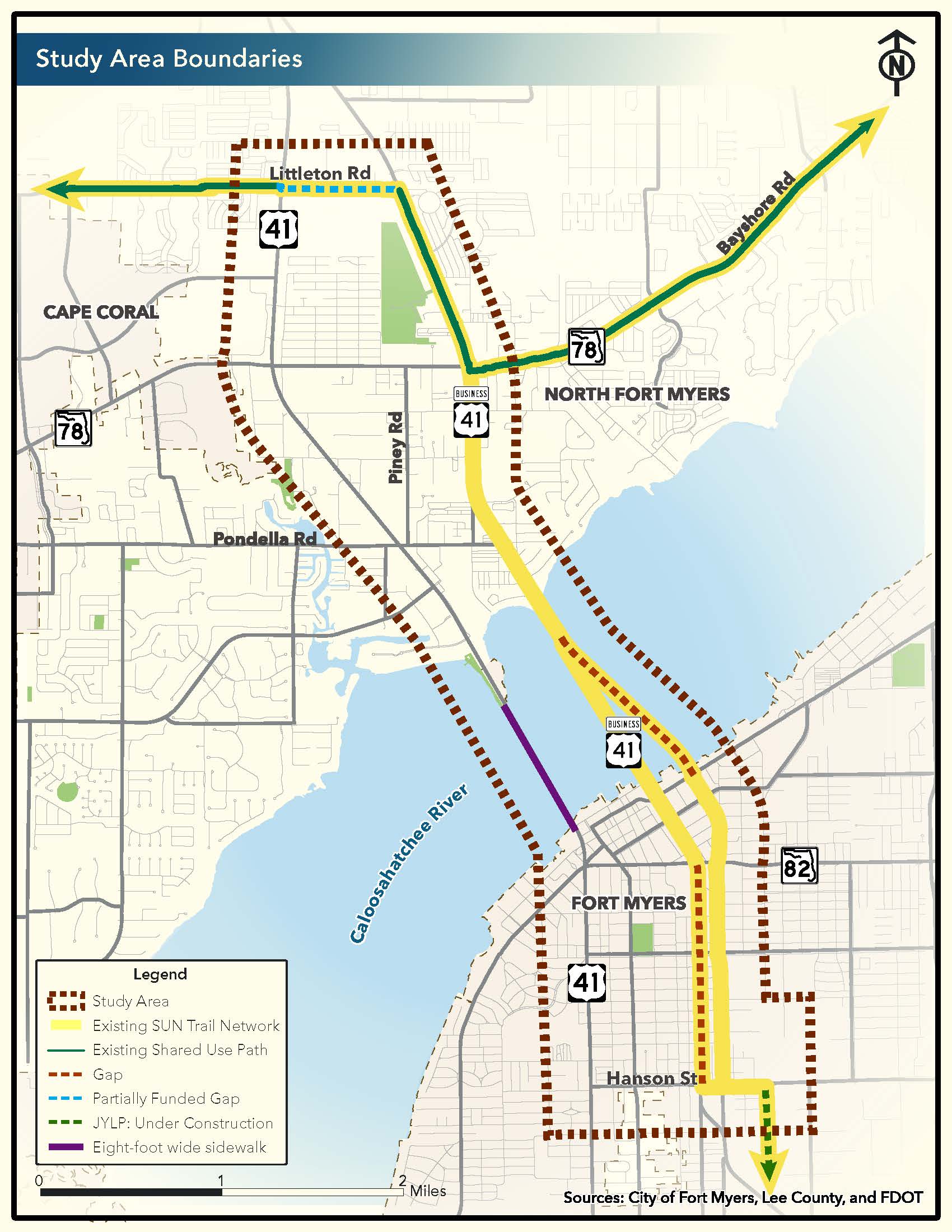
The Lee County Metropolitan Planning Organization (MPO) is studying ways to build a new shared-use path, or urban trail, in Fort Myers and North Fort Myers. The trail would cross the Caloosahatchee River using the new eight-foot-wide sidewalk on the Caloosahatchee Bridge (Cleveland Avenue).
To the northwest side, the trail would link up with the SUN Trail network along Littleton Road, which eventually becomes Kismet Parkway in Cape Coral. To the southeast, it would connect with the John Yarbrough Linear Park Trail, which is currently being extended to Hanson Street. Once completed, this new trail would officially become part of the Florida Department of Transportation’s SUN Trail network (shown in yellow on the map below).
This feasibility study will identify on-road and off-road trail alignments, evaluate them, and recommend a preferred alignment(s).
In partnership with
Demand and Usage Survey
Your opinion matters! Please take a few moments to complete a survey to help the Lee County MPO plan a new shared-use path (urban trail) in Fort Myers and North Fort Myers, utilizing the Caloosahatchee Bridge (Cleveland Avenue) sidewalk.